Ground Penetrating Radar

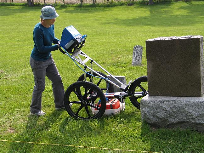
Ground Penetrating Radar is a tool that uses electromagnetic waves to image the subsurface.  The electromagnetic waves from the antenna are reflected by subsurface contrasts in conductivity, magnetic permeability, and dielectric permittivity.  The surface arrival time and amplitude of these reflections are recorded by the control unit and used to generate a GPR profile output, similar to seismic survey output. 

This technique can be used to locate subsurface utilities, underground storage tanks (USTs), stratigraphic boundaries, unmarked graves, trenches, and foundations. 

The Near Surface Geophysics Lab at Kutztown University owns a GSSI SIR 3000 GPR System and SIR 4000 GPR System with 1.6GHz, 900MHz, 500MHz, 400MHz, 270MHz, and 200MHz antennas and the processing software Reflexw.  The Lab also has a Pre-FCC 300MHz and 70MHz antenna. 

  Cemetery survey in Hastings Michigan (Summer 2010) with 400MHz antenna.

KU projects that employ GPR

2022 Mouns Jones House
2022 Joanna Furnace
2022 Bangor Church
2022 BCAGP Service Projects
2021 BCAGP Service Projects
2021 Harrisburg Mansion
2021 Fritz Cemetery
2020 BCAGP Service Project
2019 SPCGV Mass Burial

2019 Pennsylvania Cave
2018 BCAGP Service Projects
2018 Paoli Massacre Survey
2017 Charlestown Cemetery
2017 Providence Township Schoolhouse

2016 Stoddartsville Archaeology
2016 Assateague Island and Greenbackville
2016 Perkiomen Geophysics
2016 Burnside Plantation
2015 Phoenixville Cemetery

2015 Utah Mud Volcanoes
2015 Stoddartsville Archaeology
2013 Local PA Cemeteries
2013 SW Michigan Cemetery Survey
2013 Montezuma Wetland Brines
2012 Great Lakes Glacial Mapping
2012 New York Glacial Mapping
2012 Case Histories: Using GPR to Map Burrows
2011 Mapping of Groundhog Burrows with GPR
2011 Keene Valley Landslide
2010 SW Michigan Earthwork
2010 Bethlehem Cemetery - Mass Grave


GEL 358 - General Geophysics

Sherrod Home Page