SW Michigan Cemetery Survey

Laura Sherrod - 2013

A ground penetrating radar (GPR) survey was conducted in Hastings Michigan in May and July of 2010 at West Carleton Cemetery, a cemetery of approximately 5 acres. This cemetery contains burials from the early 1800s through the 1950s. There are several small clusters of headstones marking graves (below) as well as large sections within the site that have no grave markers (right).  These open or clear areas were believed by the Township Supervisor to be partially occupied. The plot records for this cemetery were lost in a fire during the 1950s and the cemetery was closed in 1959. During this time plots were sold without any record. The primary goal of the survey was to identify sections within the cemetery that could be open for purchase by residents of the area.  

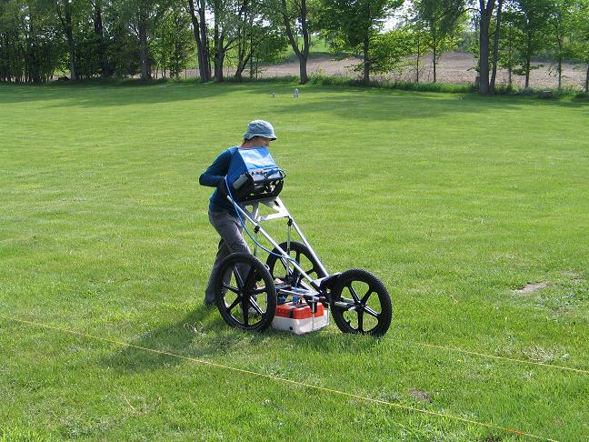
Dr. Sherrod operates the GPR at the cemetery in Hastings, Michigan. 

Several headstones remained on hills within the cemetery. 
A GSSI SIR 3000 ground penetrating radar system with 400 MHz bistatic antennae was used to survey the site in a north-south pattern with line spacing of 1.5 ft. Due to the sandy nature of the soil, the response of the GPR system was easily interpretable over the majority of the site facilitating the creation of a map of burial sites for this cemetery. Kutztown University undergraduate student Emily Snyder worked with Dr. Sherrod during the 2013-2014 academic year to compile the data into three dimensional plots.  Data were processed using Reflexw and transferred to maps in Oasis Montaj to facilitate interpretation of unmarked burials. 


A special thanks to Scott Sherrod for help with the data collection during the summer of 2010. 
SW Michigan Cemetery Survey Results Archaeological Geophysics Ground Penetrating Radar
Sherrod Home Page