Stoddartsville Archaeology Results

Laura Sherrod - 2015

The vertical magnetic gradient map (right) was produced to illustrate zones of magnetic variation.  Several linear magnetic features were investigated by the archaeologists in subsequent weeks. Surface features such as areas of boulders (as in the south central portion of the main survey block) and fencing (south east corner) may have masked signals from subsurface sources. 

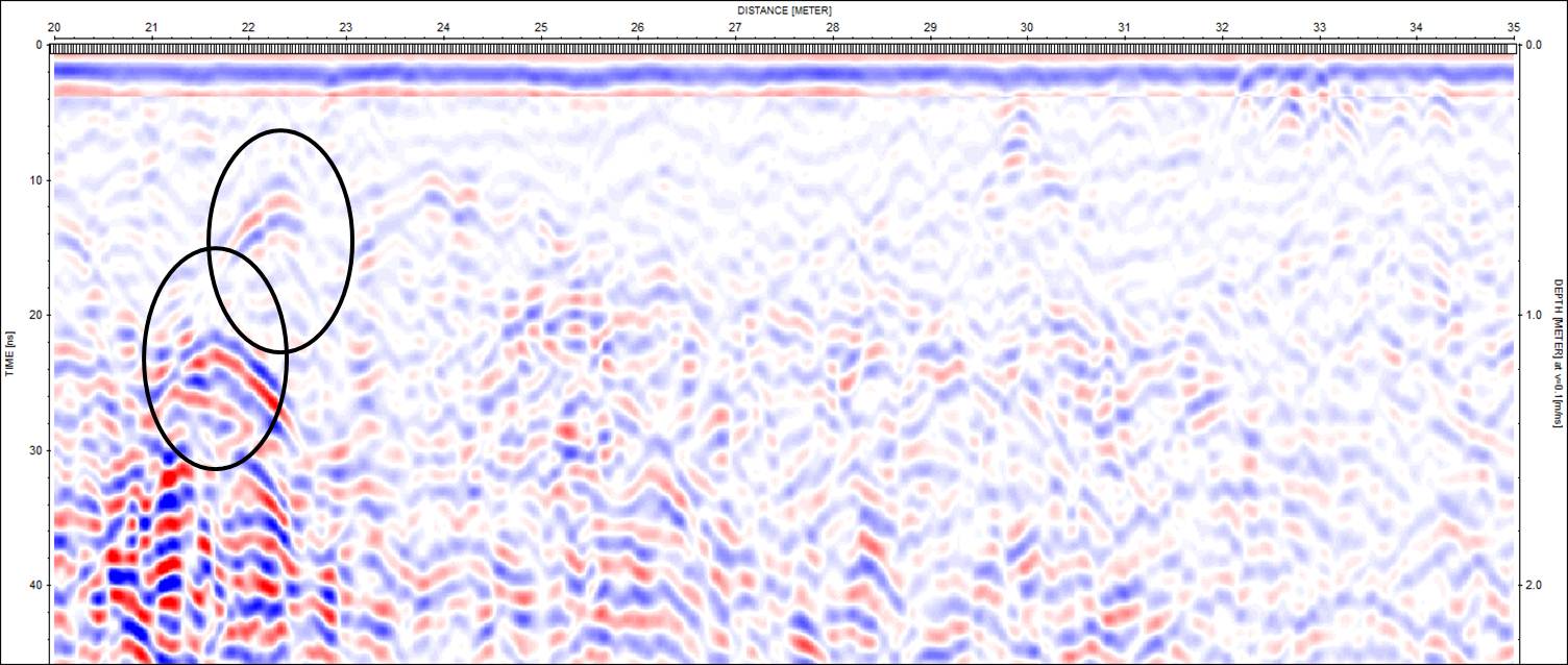
GPR data were used to pinpoint discrete objects in the subsurface.  Hyperbolic reflections such as those shown below may indicate a foundation in the subsurface. 

Archaeology students sift for artifacts Ryan Higgins walks the survey line with Ian Dr. Newlander oversees the use of the transit
Dr. Newlander and Maggie take measurements at the excavation unit Archaeology students working at the excavation unit Stones from a wall to the general store
Dr. Sherrod instructs Johnryan on the use of the magnetometer Dr. Sherrod and Maggie take notes of the data collection procedure Archaeology students work on the excavation
Stoddartsville Archaeology Archaeological Geophysics Ground Penetrating Radar
Sherrod Home Page GSKU Magnetometer