Bangor Church Foundation Results

Laura Sherrod - 2022

Geophysical investigations were performed to provide subsurface images using a 400MHz GSSI SIR 3000 GPR system and a Geometrics G-858 magnetometer in gradiometer mode.  GPR lines were spaced at 1ft and magnetometer lines were spaced at 2ft to provide complete coverage of the survey area.  

BangorSiteMap

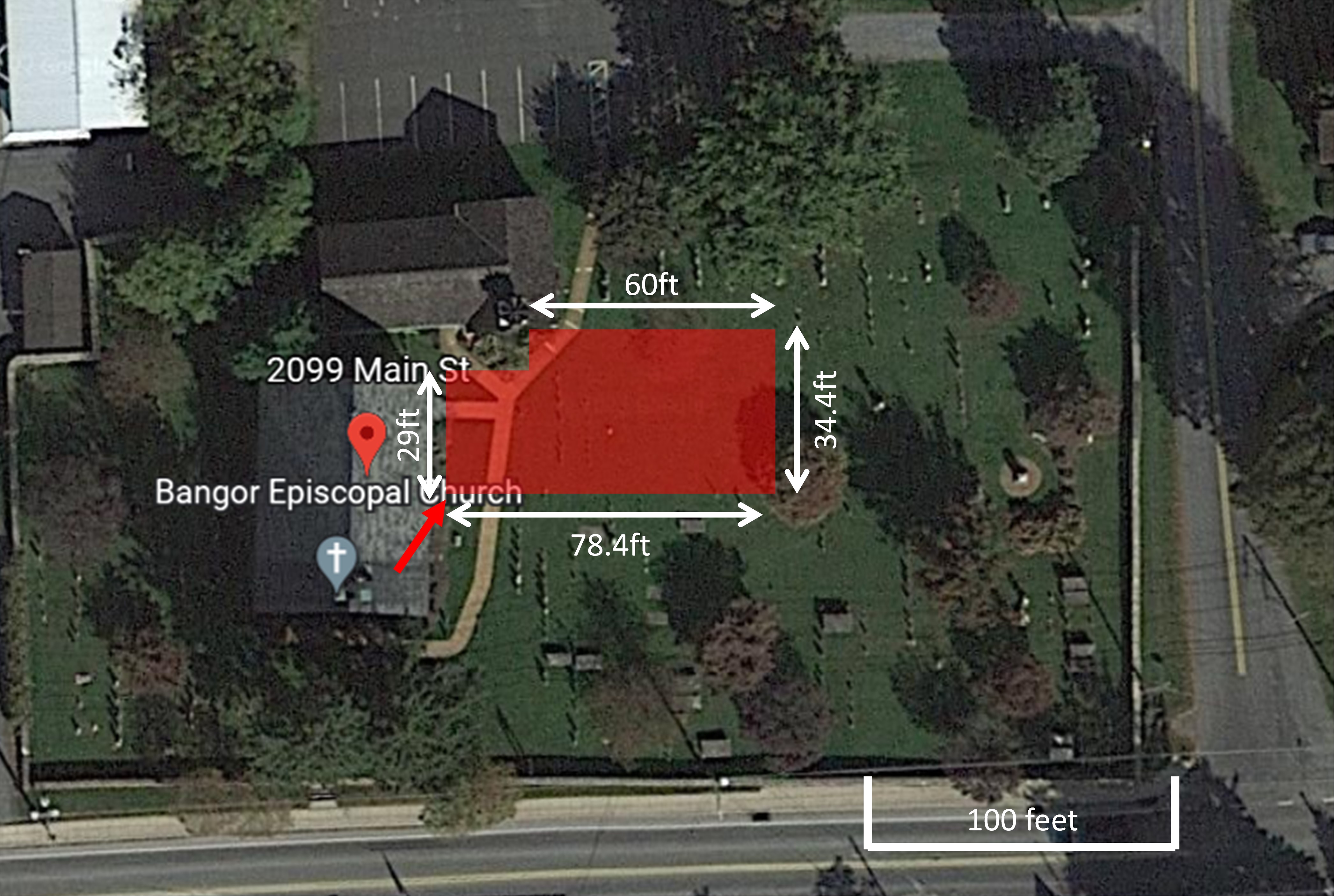
Arial view of the field site.

GPRmap

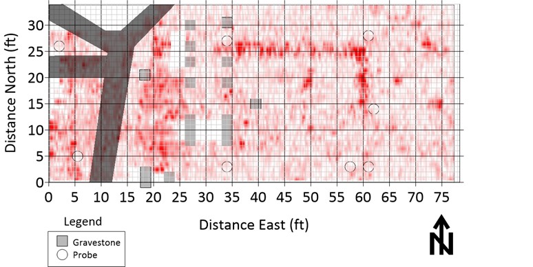
GPR time slice showing the possible northeast corner of the foundation

BangorMag

Magnetic data show the location of surface metal and some small anomalous zones. 

BangorResults

Potential foundation location as interpreted from the GPR time slices. 


Bangor3a Mag GPR
Area clear of headstones may contain the foundation Garrett Rogers operates the magnetometer Drew James operates the GPR  
Bangor Church Archaeological Geophysics Ground Penetrating Radar
Sherrod Home Page GSKU Magnetometer