New York Glacial Duck Lake Results

Laura Sherrod - 2012

The Duck Lake site is located within the Montezuma Wetland Complex.  This site has many glacial features visible at the surface and through high resolution LIDAR images.  The GPR survey line followed the contours of an esker (below) and crossed onto a drumlin (right) at the end of the road.  Three frequencies of antennae were used at this location.  The 100MHz antenna gave the greatest depth penetration but the poorest resolution.  The 200MHz antenna did not reach the same depth as the lower frequency antenna, but had improved resolution.  The 400MHz antenna provided a shallow penetration depth but greatest resolution.    The images shown on this page were produced by the 200MHz antenna.

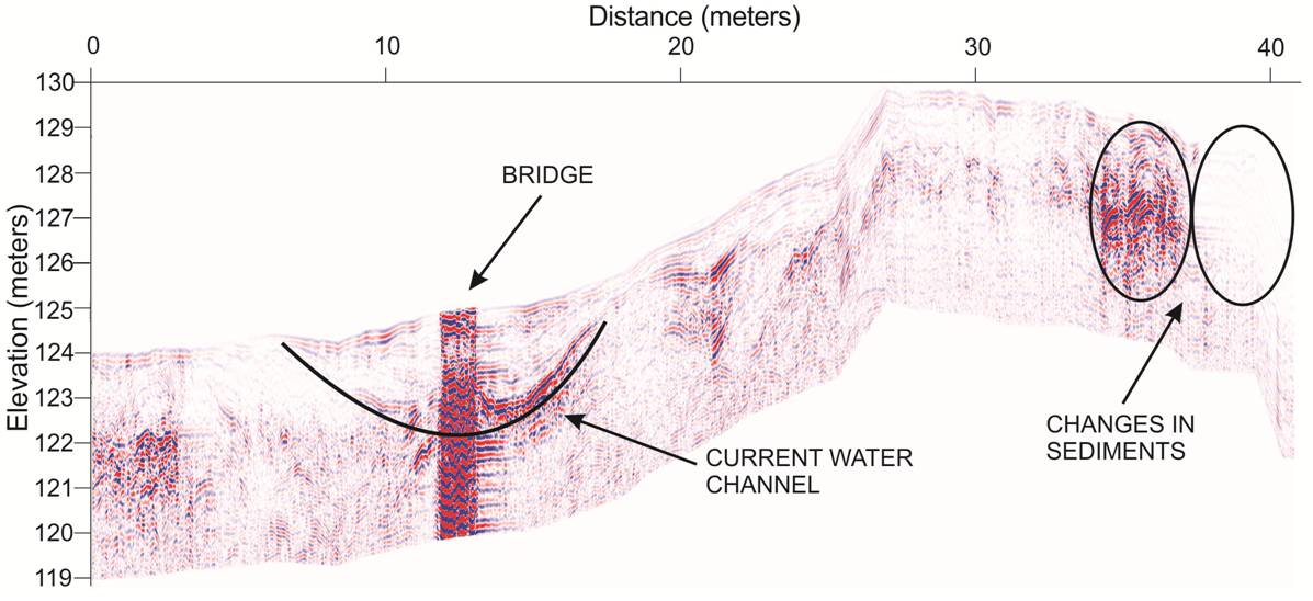
Image of GPR profiles crossing a drumlin (results from the 200MHz antenna).


The GPR profile over the esker (results from the 200MHz antenna).

GPR images of the drumlin appear highly attenuated due to the high clay content of this glacial feature.GPR images of the esker show features such as braided gravels in the subsurface, demonstrating the high flow of the subglacial river that deposited these sediments. 
Dea Musa connects the GPR system to the field vehicle to tow along the road.  Dea Musa holds the 200MHz antenna to slow its rate on the downhill sections. The drumlin contains a high quantity of subsurface clay that washes out the GPR image. 
Dea Musa connects the bistatic 200MHz GPR for the survey over the esker.  Bistatic 100MHz antennae provide deeper penetration of the subsurface than the 200MHz and 400MHz antennas.  Dr. Kozlowski checks the connection of the 100MHz antennae behind his field vehicle. 
2012 New York Glacial Mapping
Lyons Geophysical Results
Geologic Mapping Ground Penetrating Radar
Sherrod Home Page   Resistivity