|
Geophysical investigations
were performed to provide subsurface images
using a
400MHz GSSI SIR 3000 GPR system and a Geometrics
G-858 magnetometer in
gradiometer mode. Lines
were spaced at 1ft to provide complete
coverage of the survey area.
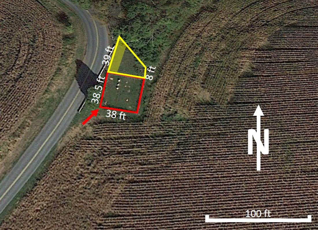
Arial view of the field site.
|
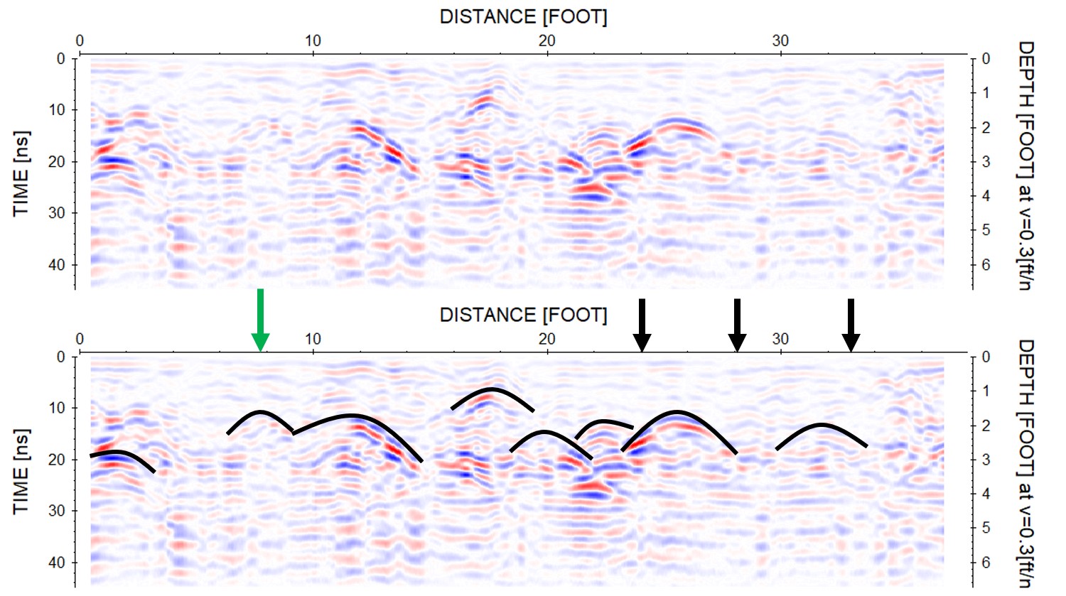
GPR profile showing several potential
unmakred burials
|