|
Due to the contrast
between the moderate resistivity of the
glacial sediments saturated in fresh water
(approximately 10-100 ohm*m) and the very
low resistivity of glacial sediments
saturated in brines (less than 1 ohm*m), the
subsurface brines are clearly visible as low
resistivity (blue) anomalies in the
resistivity profiles. The image to the
right shows the resistivity results of three
155m sections of the 2km east-west transect,
with the western most survey (top) showing
relatively high resistivity compared to the
eastern most survey (bottom).
Combining these results with those from the
north-south resistivity transect, it is
apparent that the brines are prominent in
the east and north of the area surveyed.
Boreholes located within the lines of the
geophysical surveys indicate that the brines
are found primarily in fine to medium sands.
|

Resistivity of the
east-west transect from west (top) to east
(bottom)
|
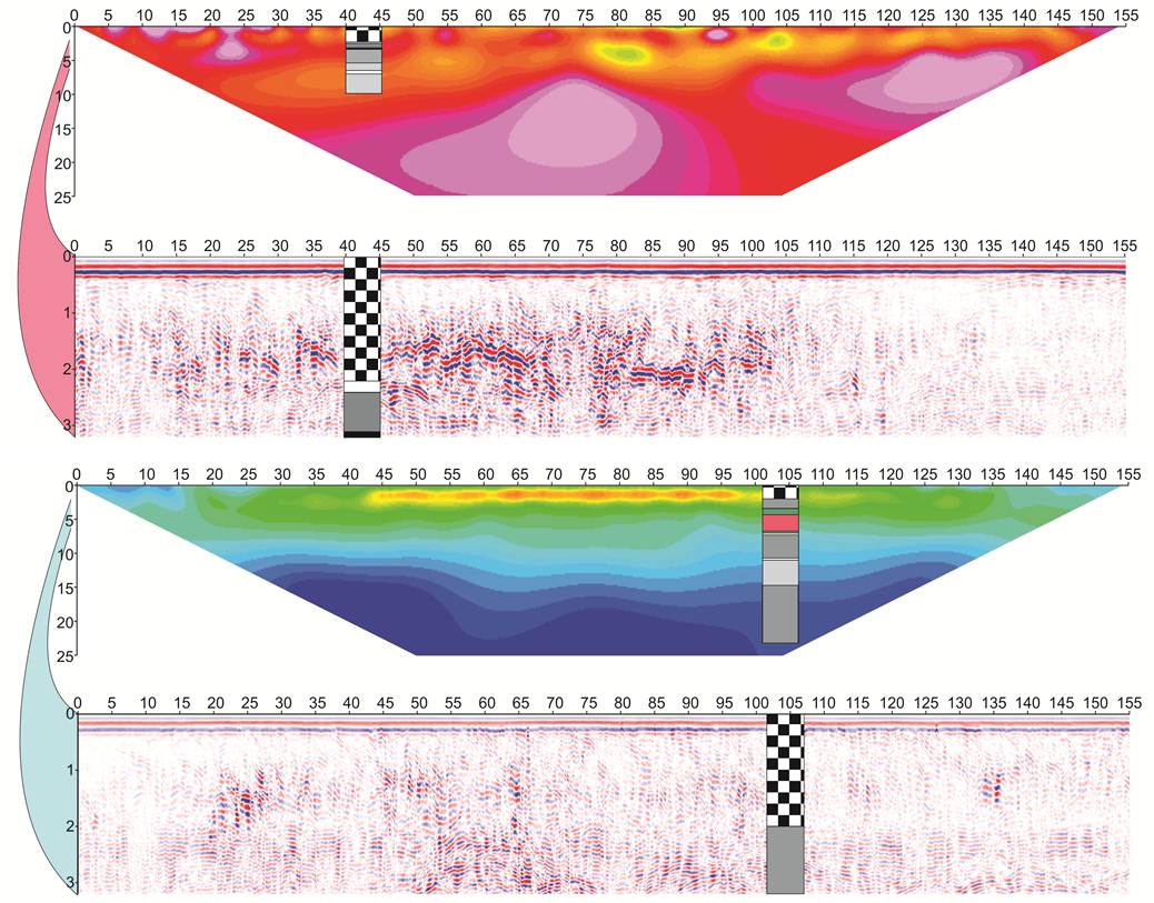 GPR
results of the east-west transect
corresponding to the western (top) and
eastern (bottom) resistivity surveys. GPR
results of the east-west transect
corresponding to the western (top) and
eastern (bottom) resistivity surveys. |
The image to the left shows two examples of
the GPR results compared with the
resistivity profiles. The depth of the
resistivity profiles (approximately 25m) is
much greater than the depth of the GPR
profiles (approximately 3m for the 200MHz
antenna). As the surveys were
performed on dirt roads built in the
wetland, the upper two meters of the GPR
profiles show the fill material of the
roads. Results from the 200MHz GPR
antenna were better quality than the 100MHz
results due to the shallower depth of
penetration for the higher frequency
antenna. However, these 200MHz
profiles were not useful for identifying
brines as the image was focused within the
fill material instead of in the lower
resistivity glacial deposits. Overall,
the results of the GPR surveys at the
Montezuma Wetlands site show an attenuated
image of the subsurface structures due to
the high electrical conductivity of the
subsurface.
|