Relating to the
Schuylkill Watershed Abandoned Mine Drainage
Project of 2011, this project was an
investigation of flow losses in the
headwaters of the Schuylkill River west of
Minersville. Dr. Chuck Cravotta, a
geochemist with the
United States
Geological Survey stationed in
Harrisburg, assisted undergraduate
researcher Rick Jayne and Dr. Laura Sherrod
in the development of a stream gauging and
monitoring program that would define areas
of flow loss in the West West Branch of the
Schuylkill River over the Spring 2012
Semester. Several field locations were
chosen for stream gauging and water quality
measurements.
Due to low precipitation in the winter and
spring months, water flow in the streams of
this region were much lower than normal.
Discharge and water quality measurements
were taken only twice after the spring thaw
of the rivers - 13 March and 18 April. The
first round of measurements indicated flow
loss in the northwestern section of the
stream channel between stations 4 and 6.
The second round of measurements confirmed
these results. |
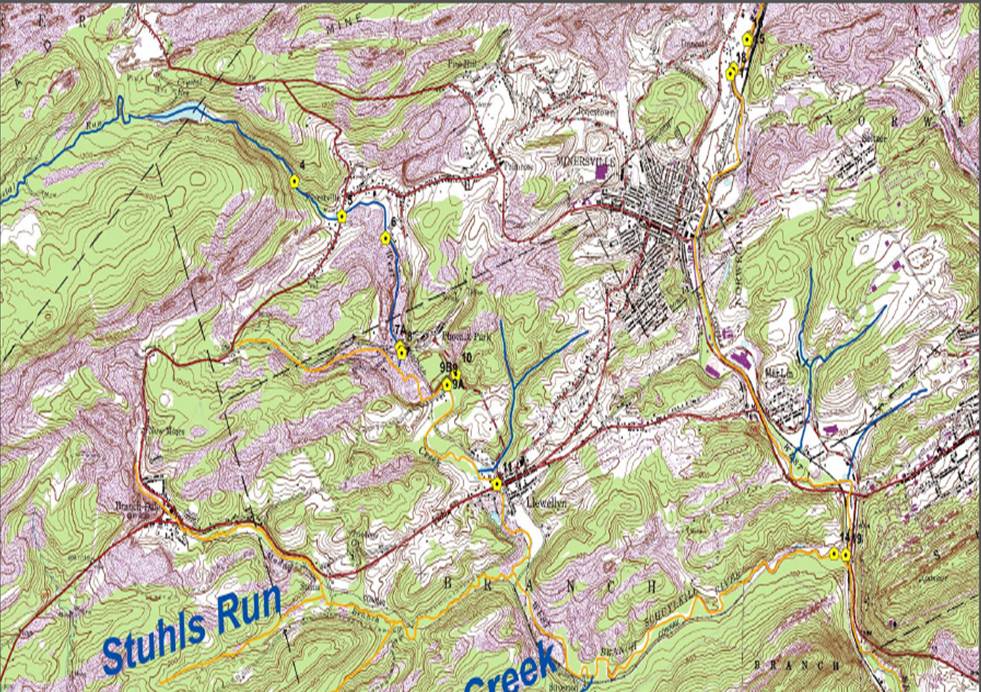
Map of eight stations
designated for gauging and water quality
measurements |

Chuck Cravotta and Rick Jayne take discharge
measurements at station 9 |
Visual observations of the stream
channel during the April measurement cycle
gave a direct view of flow loss as shown to
the right, with some sections of the river
containing small volumes of discharge and
other sections of the river completely dry.
This concrete evidence led to the
application of geophysical methods in this
section of stream channel to visualize the
flow loss beneath the stream channel. |
|
A series of resistivity surveys was
performed over the stream segments where
flow loss was visible to constrain the
interpretations for the Schuylkill Watershed
resistivity surveys. The results of these
surveys pinpoint flow loss in the stream
channel. Remediation of this area
would be possible by sealing the base of the
stream channel from flow loss. |
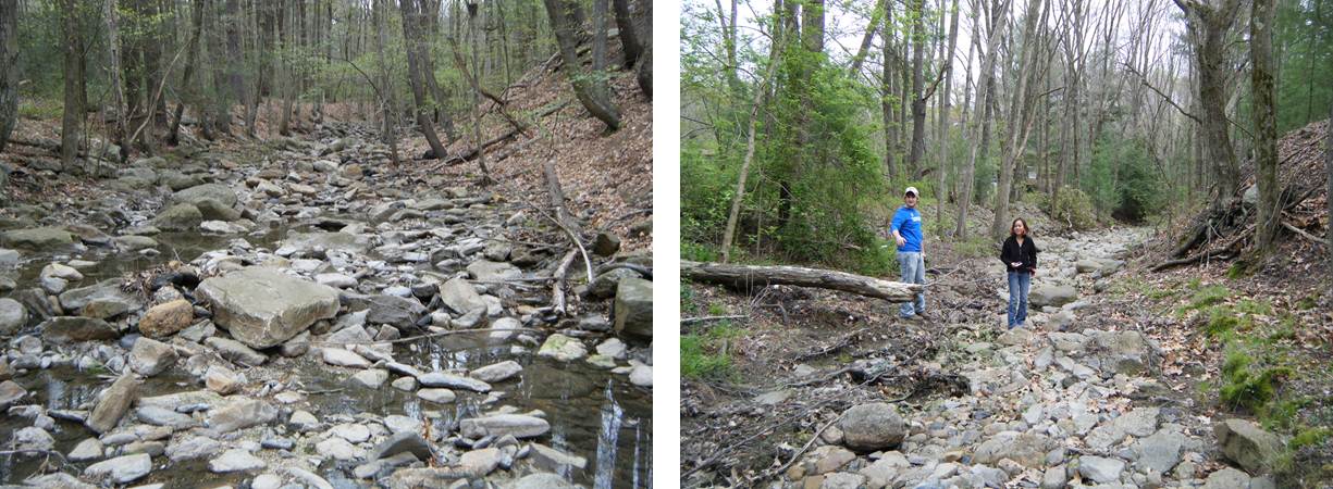
The location of flow
loss was visible in April 2012 |