|
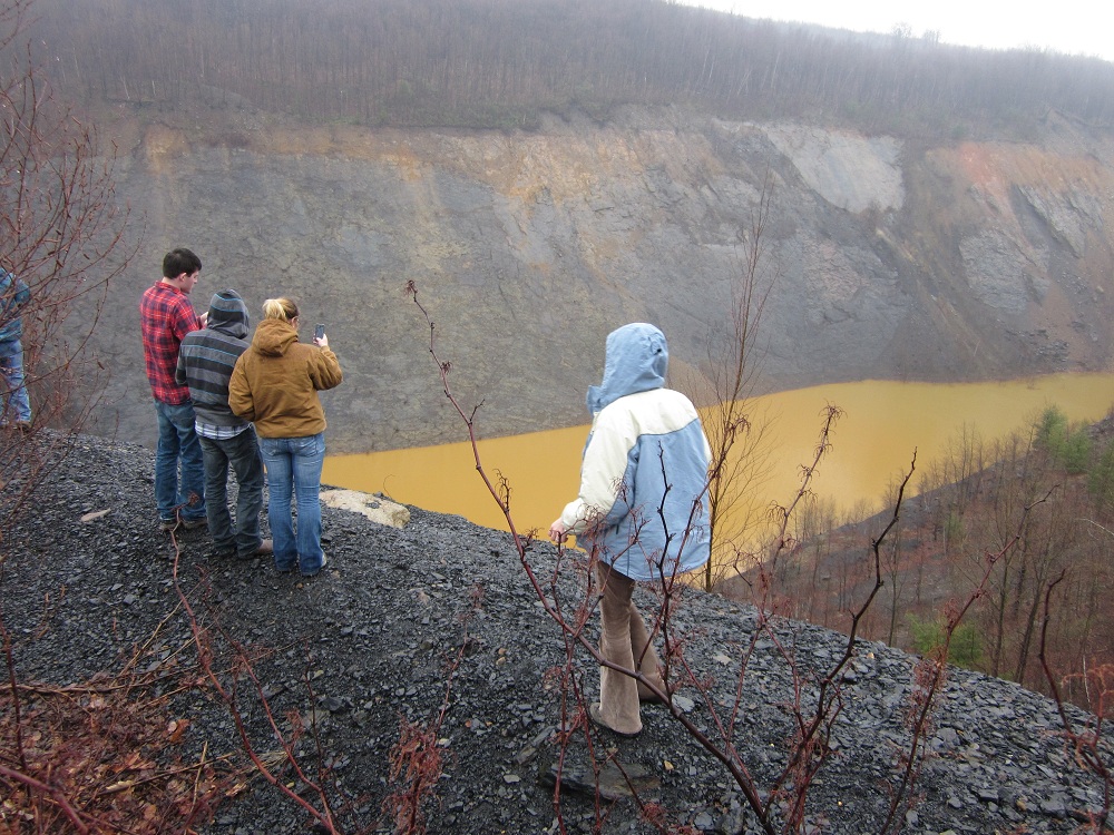
Abandoned mine drainage in the
Schuylkill Watershed severely impacts stream
quality and aquatic habitat. Rainwater
infiltrates the ground, making its way into
abandoned mine tunnels, where chemical
reactions make the water strongly acidic and
dissolve toxic metals from the rock before
the water discharges into mountain streams.
Remediation efforts are underway to decrease
the total volume of water which flows
through abandoned mines and into stream
channels. However, the source locations of
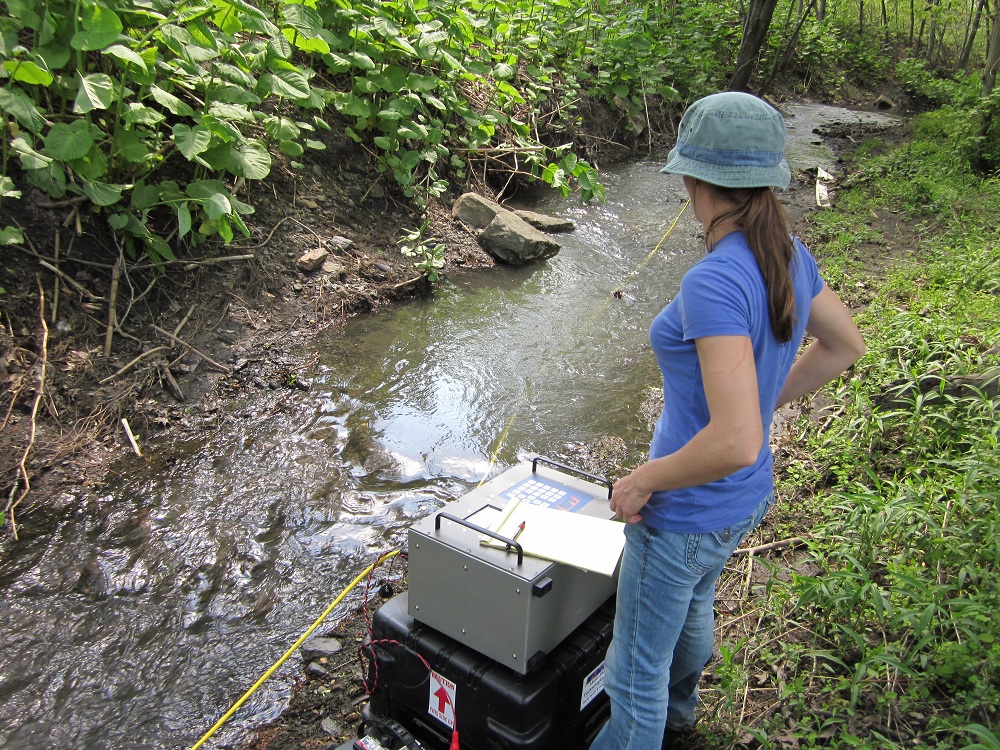
such water are challenging to identify. A
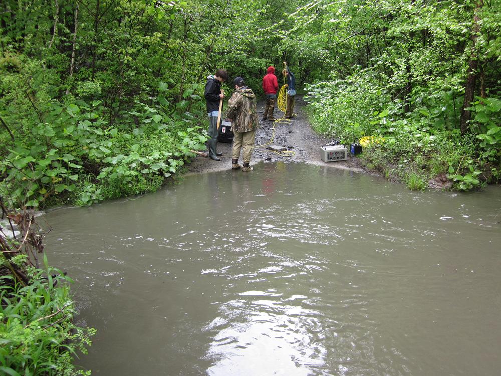
resistivity survey is performed by applying
an electrical current to the ground and
monitoring the resultant change of
electrical potential caused by the current
flow through the subsurface. Due to the
relatively high electrical conductivity of
water compared to the surrounding rocks and
sediments, regions of water seepage are
recorded as low resistivity (high
conductivity) anomalies. This method has
been applied in river channels in the
Schuylkill headwaters to locate areas where
remediation efforts should be focused. Dr.
Sherrod has been working with the
Conservation District and the
Schuylkill Headwaters Association to
address this problem through geophysical
investigations of the West Branch Schuylkill
River and Dyer Run. An EPA grant was
obtained to hire an engineering firm,
Alfred
Benesch and Company, to perform the
necessary field work. During the summer of
2011 Dr. Sherrod and her team of
undergraduate researchers, Jarred Swiontek
and Jeff Kadegis, employed Kutztown
University’s multichannel resistivity meter
to participate in the field work and data
processing. The results of these
investigations will be used to target zones
of high priority for future remediation
efforts. |
 |
|
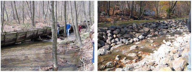
Before
After
|
Before (left) and after (right) photos of a
stream that was sealed to decrease
recharging of the mine pool through a seep
in the stream channel.
The old flume (wooden structure,
left) was removed in the remediation process
and the base of the stream was lined with
large rocks and cement.
Only a small section of the stream
was sealed as the point of seepage at the
stream channel base was visible.
The flow velocity of this stream
required the use of rip rap (large rocks on
the sides of the stream channel) and
concrete (at the base) instead of sealing
techniques that result in a more natural and
aesthetically pleasing stream channel.
|
|
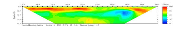
The example
resistivity profile (right) shows an area of
low resistivity (blue) beneath the stream
channel.
This profile was completed by the
consulting firm which was hired in 2009
(Dietz-Gourley
Consulting, LLC).
|
 |
 |
 |
| MPT Das-1 Electrical Impedance
Tomography System |
High water levels in June 2011 |